
Shelby Road Phase II - Delayed By Corp of Engineers
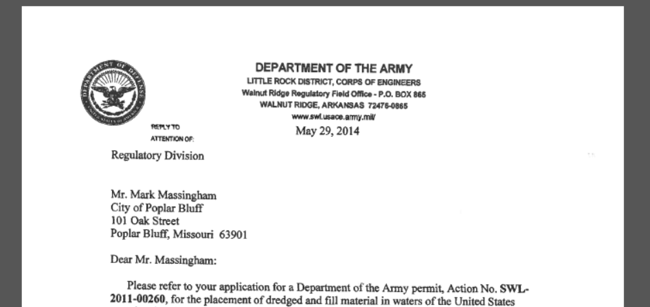
In a letter from the Little Rock District of the Corp of Engineers to the City of Poplar Bluff, Project Manager Louis Clark alerted the City Manager that they had 30 days to respond to the issues raised by multiple agencies regarding the second phase of Shelby Road which was to extend from Kanell Blvd (PP Hwy) south and east to the intersection of Business Hwy 67 and Hwy 53. This builds a second north-south business corridor allowing for better traffic flow and continued business development for the Poplar Bluff area.
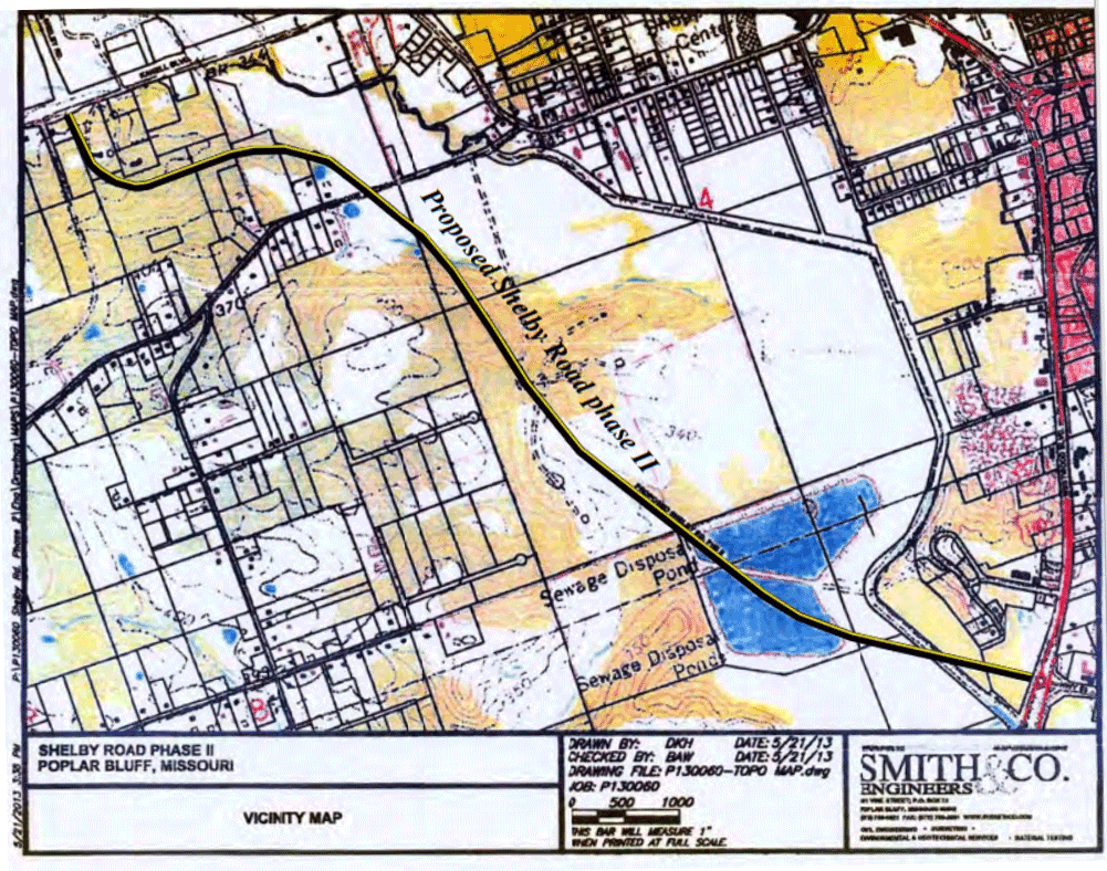
Shelby Road Phase II Proposed Route
The letter states that the Environmental Protection Agency, the Missouri Department of Conservation and the Missouri Department of Natural Resources were all concerned with the mitigation efforts as stated in the City’s application. The Corp was even more specific on their concerns:
The concerns of the Corp of Engineers include, from a cultural resource perspective, is that the project has the potential to impact cultural resources and therefore a cultural resources survey of the final road alignment is required. The road project is within the 100-year floodplain and the floodplain of Pike Creek. Appropriate waivers and permits must be obtained prior to construction in these areas.
The Corp goes on to suggest two alternate routes the city consider rather than the current one which cuts across abandoned sewage lagoons and drops into the floodplain.
…modifying the road alignment so it runs west from Business 67 and Hwy 53 intersection to the approximate location of CR-485 and then run north, parallel to CR-465 to the south end of Shelby Road. Another alternative might be to stay on the east side of Pike Creek, running behind businesses on the high ground and then crossing Pike Creek in the vicinity of Roxie Road and then meeting with the southern end of Shelby Road. It appears that both of these alternatives may reduce impacts to the floodplain and floodway, as well as impacts to the waters of the United States.
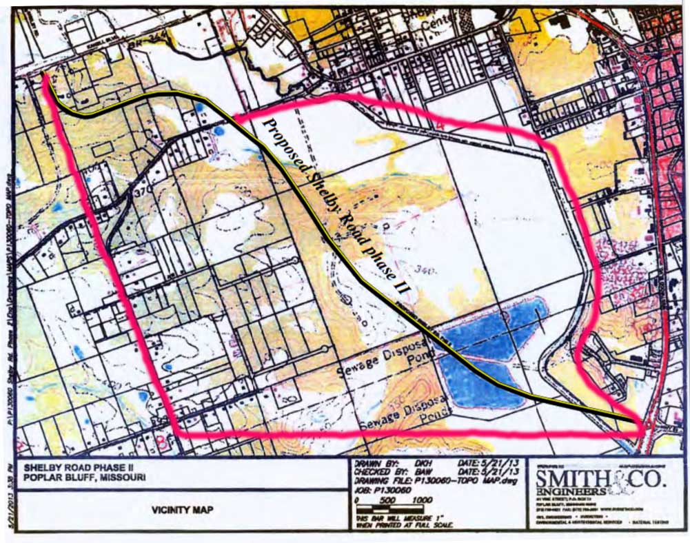
Artist rendering of alternative routes suggested by Corp
The last thing the south side needs is another highway funneling more water toward the 53 corridor. Hopefully one of the alternative routes will alleviate much of the flood concern and provide another business corridor through our city.
TAKE A LOOK AT THE LETTER IN THER DAR ON Thursday…A VERY RESPECTFUL SUBMISSION BY R. GARCIA…THE WRITER VOICED THE VIEWS OF MOST READERS… PERSONAL ATACKS THAT ARE BENEATH THE ROLE OF PUBLISHER. HIS NASTY ANGRY RESPONSE TO THE GARCIA SUBMISSION IS PROOF THAT HE IS NOT A GENTLEMAN OR FAIR IN ANY SENSE OF THE WORD. PLEASE NOTICE THAT HE DID NOT ANSWER THE CONCERN OR REASON FOR THE LETTER BUT LAUNCHED INTO HIS HATE NEW COUNCIL ADORE BAGBY MODE. I THINK WE NEED TO START CONTACTING THE OWNER OF THE PAPER AND EXPRESS OUR DISGUST…. AND START CANCELLING THOSE SUBSCRIPTIONS. AS A PARENT, I FOUND IT TROUBLING TO HAVE TO EXPLAIN THE CARTOON TO MY CHILDREN…. ALL UNDER THE AGE OF 8. SHAME ON SCHREIBER…
WONDER HOW DON SCHREIBER AND OTHER SORE LOSERS WILL BLAME THIS DEBACLE ON THE NEW COUNCIL???? I BELIEVE SOME OF THIS SHODDY HALF THOUGHT PLANNING WS ONE OF THE REASONS THE OLD COUNCIL AND BAGBY FOUGHT SO HARD TO HOLD THEIR SEATS. NOW WE WILL GET TO SEE THE DIRTY LINEN….MORE TO COME I THINK WHEN ANGELA SECURES DOCUMENTS UNDER DISCOVERY… STAY TUNED! ALSO BLAMINING COUNCIL SELECTION AND OTHER ISDSUES ON BRIAN BEKER IS LIKE SLOWBAMA BLAMING BUSH FOR
EVERYTHING….
Has land been purchased?
Who oked the purchase?
Was there any public meetings to discuss flooding issues?
Is this a walt disney production (mickey mouse operation)